Saturday, June 30, 2018
Warp Factor Eleven
Warp Factor Eleven
The UK Onshore Geophysical Librarys William Smith - Interactive has wound me up. It represents a cartofail thats extremely common.
William Smith produced his classic and beautiful maps of the Geology of England and Wales in the early 1800s. They are stunning. making them available digitally is also wonderful but...and this drives me nuts - why oh why, time and time again do we see people scan these wonderful old maps and then warp them to Web Mercator?
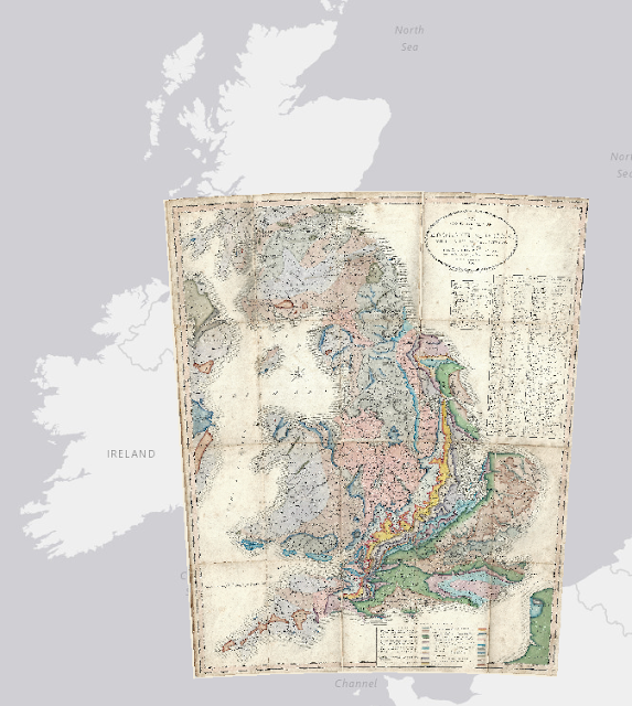
Theres a reason Smith chose the right projection for his maps....because it was the right projection.
Would it not be easier to just change the projection of the web map service youre using and then allow the maps to be seen as intended? Instead we get the maps stretched and distorted. Horizontal text also becomes stretched and sits on a curve. It looks absurd.
200 years ago Smith made his map right. The very least we can do is honour it by using modern technology to re-present his work properly, not turn the warp factor up to eleven.
Subscribe to:
Post Comments (Atom)
No comments:
Post a Comment
Note: Only a member of this blog may post a comment.